Areté provides rapid, creative, end-to-end development capability to address challenging problems.
Areté’s maritime expertise doesn’t stop at the surface of the sea. Our understanding of the complex and challenging undersea environment is robust. Areté specializes in non-acoustic detection of items of interest undersea. We are the commercial transition partner and integrator for the advanced sensor package (ASP) for the Mk 18 UUV. Additionally, Areté is a key contributor to the Submarine Security Program. Key customers include the U.S. Navy and the Defense Advanced Research Projects Agency (DARPA).

ALMDS
Airborne Laser Mine Detection System
Challenge
Traditionally, reconnaissance of seafloor or deep sea mines required several steps: send an aircraft such as a Fire Scout to retrieve information, bring the Fire Scout back to download its data, then neutralize the mine. Every second is critical in a battlefield or reconnaissance scenario. ALMDS gives the capability to perform reconnaissance, send data, and launch mine countermeasures at virtually the same time.
We discovered a way to manufacture a 3D streak tube imaging lidar (STIL) sensor that’s fast, accurate, and has a broad field of view.
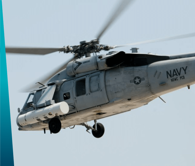
We developed ALMDS, a sensor pod that sends data back to the command deck in real time. The helicopter-mounted ALMDS detects, classifies, and geo-tracks undersea moored sea mines in sea lanes and other navigable waters.
We delivered our ALMDS solution initially to Northrop Grumman as part of a larger Navy contract. However, we’re also adapting ALMDS to be part of a multi-spectral option that can locate mines on the sea floor or deep sea as well as in high-clutter environments such as surf and white caps, all at low size, weight, and power usage — still perfect for unmanned air systems such as Fire Scouts — because the modern battlespace requires faster decision making.

PILLS
Pushbroom Imaging Lidar for Littoral Surveillance
Challenge
The U.S. Navy has long needed accurate bathymetric lidar and topographic mapping capabilities for waterways and seafloors. However, existing technologies lacked the precision and reliability required for mission-critical operations.
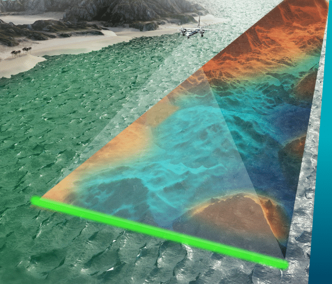
We discovered a way to integrate a pulsed laser fan beam with a Streak Tube Imaging Lidar (STIL) receiver. This breakthrough delivers exceptional accuracy, solving the challenge of mapping complex underwater and coastal environments.
We developed a lightweight, compact system requiring minimal power that can be mounted on an aircraft’s undercarriage. With every laser pulse, the PILLS system creates detailed images of objects within the fan beam, while forward motion maps a three-dimensional representation of the terrain along the flight path. This enables highly accurate bathymetric lidar and topographic data collection.
We delivered the PILLS system to the U.S. Navy, equipping them with a cutting-edge solution for accurate bathymetric and topographic mapping. PILLS exemplifies Areté’s ability to blend legacy technologies, like STIL from the 1960s, with modern science and engineering to deliver innovative, low-SWaP solutions to significant sensing challenges.
