BATHYMETRIC LiDAR
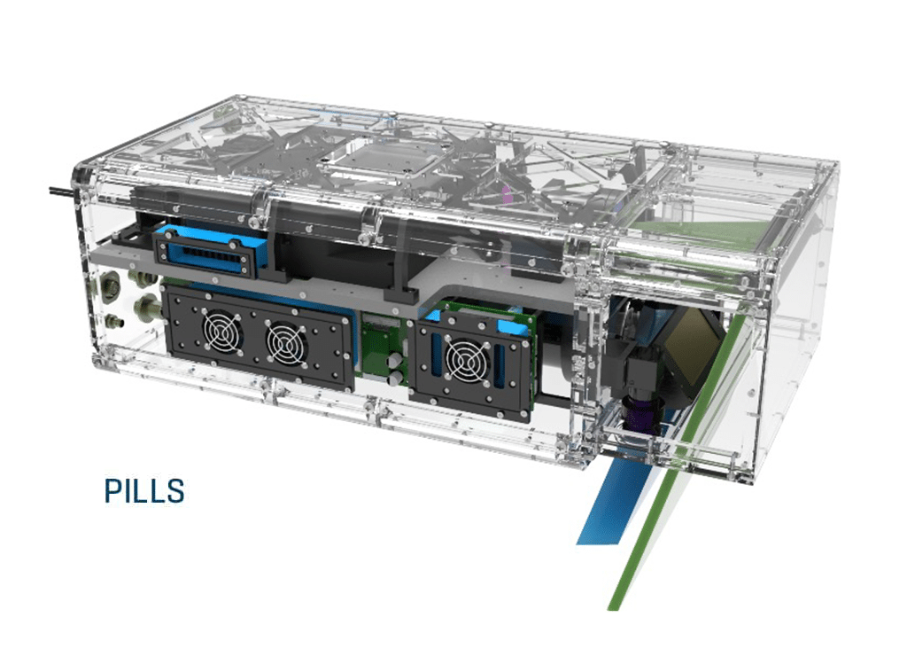
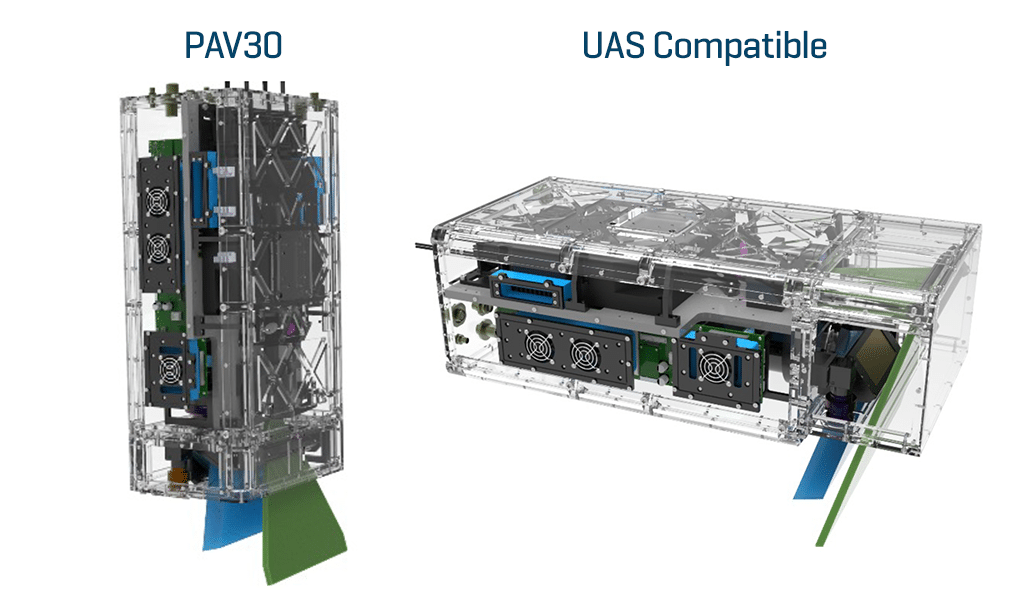
The Pushbroom Imaging LiDAR for Littoral Surveillance (PILLS) system was jointly developed by ONR and NAVAIR under SBIR funding to provide airborne LiDAR bathymetric and target detection capabilities utilizing Areté’s Streak Tube Imaging LiDAR (STIL) technology. The PILLS system has gone through three defense related iterations resulting in increased resolution, increased dynamic range, on-board real-time processing, and increased pulse rate frequency (PRF) through scalable laser modules. The PILLS system has flown on nine different commercial aircraft to date. Additionally, Unmanned Aerial System (UAS) flight tests have been completed on both the Seahunter UAS and the Schiebel CAMCOPTER® S-100. The S-100 is currently used by 45 countries and its small footprint provides a substantial payload capacity (110lbs.), power (1kw), and volume, without requiring additional launch or recovery equipment for land or ship-based operations.
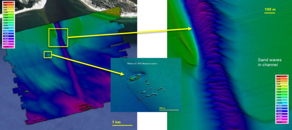
Advanced Naval Technical Exercise (ANTX) 2019 PILLS data collection Pensacola Bay Channel and the wreck of the USS Massachusetts.
Low SWaP-C Tactical Airborne Bathymetric Lidar Solution
The PILLS program delivers a new generation of low Size, Weight, Power, and Cost (SWaP-C) LiDAR systems designed for advanced hydrographic surveying and target detection. Built for seamless integration with tactical-class Unmanned Aerial Systems (UAS), these sensors meet International Hydrographic Organization (IHO) (IHO) Standard 1A accuracy and depth requirements. The sensor creates a new niche in small, airborne, depth-penetrating LiDAR systems, expanding mission possibilities for compact platforms.
PILLS Capabilities
- Commercial International Hydrographic Organization (IHO) 1A Mapping
- Tactical Bathymetry
- Target Detection
Commercial Deployment of PILLS Technology
In 2018, Areté, in collaboration with Fugro, USA, a commercial hydrographic mapping company, customized the PILLS technology for commercial use. The reduced SWaP-C, efficient swath coverage, comparable depth penetration, and equivalent accuracy to existing commercial LiDARs made the PILLS technology attractive to the commercial sector. Fugro has multiple systems in the field, under the commercial moniker Rapid Airborne Multibeam Mapping System (RAMMS).
Interested in Purchasing?
Thanks for your interest in Areté’s products. We look forward to your questions and comments and look forward to assisting you.